
Details on the installation of a geodetic network in Istanbul: What is it, how does it work?

Installing a geodetic network is a fundamental step in surveying and construction projects. But what exactly is a geodetic network, and why is it so important in a large and complex city like Istanbul? This article explains briefly and clearly what installing a geodetic network is, how it works, and what aspects need to be considered.
What is a geodetic network?
A geodetic network is a coordinate system used to precisely determine the positions of points on the Earth's surface. It serves to improve the accuracy of terrain measurements and to ensure the stability of foundations for construction projects. The precise determination of reference points is particularly crucial for infrastructure and construction projects in large cities.
The geodetic network is supported by GPS, total stations, and other measuring instruments. This ensures coordination between different projects and minimizes errors.
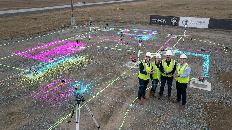
Details on the installation of the geodetic network in Istanbul
In a city like Istanbul, with its dense development and complex geography, building a geodetic network requires specialized planning. Here are the basic steps:
Planning and analysis: First, the topographical features of the site and the condition of existing buildings are analyzed. Reference points are defined during this phase.
Point selection: Fixed points are selected as the basis of the network. These points must be reliable and unchanging in the long term.
Measurement and data acquisition: The coordinates of selected points are measured precisely using devices such as GPS and total stations.
Data processing: The collected data is processed in a computer environment, error margins are calculated, and the accuracy of the network is checked.
Network construction: Finally, the geodetic network is completed by establishing mathematical connections between all points.
This method ensures high accuracy, even in the challenging terrain of Istanbul.
Points to consider when installing a geodetic network
Several critical points must be considered when installing a geodetic network:
Choosing the right reference point: Fixed and unchanging points are preferable. For example, natural rock formations or reinforced concrete structures are well suited as reference points.
Instrument calibration: Measuring instruments should be calibrated regularly. Otherwise, measurement deviations will occur.
Weather conditions: Weather conditions can significantly affect GPS measurements. Measurements taken in cloudy or rainy weather can lead to errors.
Data backup: The collected data must be backed up and stored in a secure environment.
Expert team: The team conducting the survey must have experience in geodesy.
These elements ensure the reliability and longevity of the network.

What distinguishes the installation of a geodetic network in Istanbul?
Istanbul, due to its geographical structure and high population density, presents particular challenges for the development of a geodetic network. Within the city:
High building density: There is a risk of interference with the measurement signals.
Located in an earthquake zone: The resilience and flexibility of the network will be crucial.
The juxtaposition of historical and modern buildings: The selection of reference points should be more careful.
For these reasons, the installation of geodetic networks in Istanbul is carried out more carefully and in greater detail than usual. Furthermore, customized solutions are developed to meet the needs of various industries.
While infrastructure projects, for example, often use reference points for the exact location of subway lines, industrial plants prefer networks supported by 3D laser scanning.
In this context, the installation services for the geodetic network in Istanbul offer high accuracy and reliability.
The contribution of installing geodetic networks to projects
The installation of a geodetic network offers the following advantages in architectural and construction projects:
Correct positioning: Ensures that buildings and infrastructure elements are erected in the exact right location.
Time and cost savings: Reduces the need for rework due to inaccurate measurements.
Project coordination: Enables different teams to work together on the same reference system.
Risk reduction: Enables more robust planning with regard to earthquakes and other natural disasters.
These advantages improve the quality and safety of projects.
Next steps and recommendations
Installing a geodetic network in large cities like Istanbul is a complex but essential process. For the project to succeed:
Seek advice from experts: Support from experts in the respective field prevents mistakes.
Staying technologically up-to-date: The use of new measuring techniques and devices provides an advantage.
Continuous updates: To keep the network up to date, regular checks should be carried out.
Data management: The collected data should be regularly archived and analyzed.
These steps ensure a smooth project flow.
At KG Engineering, we use the latest technologies in 3D laser scanning and geodetic network installation in Istanbul to create digital copies of structures and offer comprehensive engineering services.
The installation of geodetic networks is a cornerstone of architectural, construction, and infrastructure projects in Istanbul. Careful planning and execution ensure the highest accuracy and reliability in your projects. Remember: a solid foundation is the key to success.


Comments