
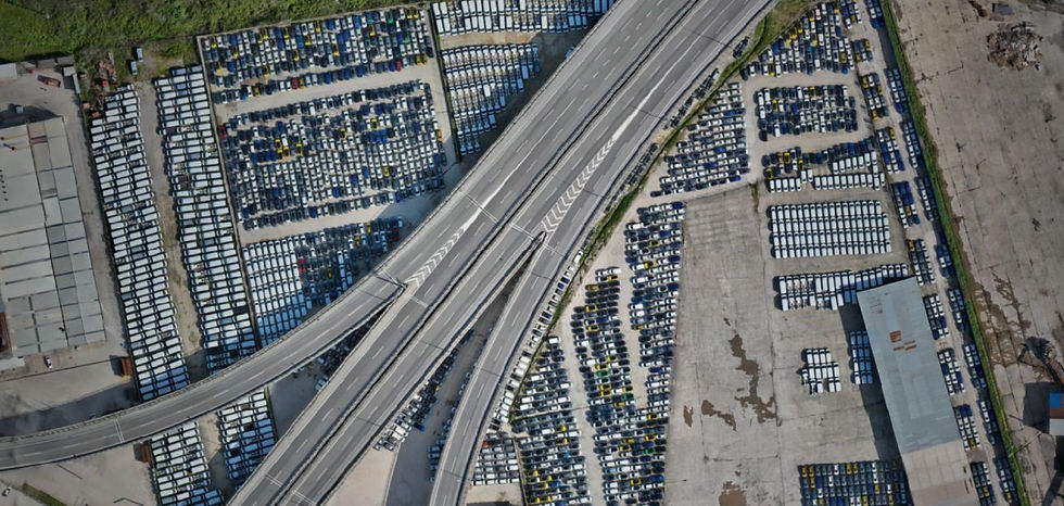
Stockyard Measurement with MAIS UAV Systems
High-Precision Ground Map Measurements with Drones
A high-precision mapping project using unmanned aerial vehicles (UAVs) was carried out to manage the inventory and determine the current status of the large stockyards within MAIS. In these large areas, where traditional measurement methods are both time-consuming and pose occupational safety risks, drone technology provided fast, reliable, and highly accurate data.
Technical Implementation and Methodology:
Aerial Photogrammetry with UAVs: The project area was scanned using professional UAV systems equipped with high-resolution sensors, following autonomous flight plans. During this process, coordinate data with centimeter precision was collected from every point of the site.
Digital Surface Model (DSM) and Orthophoto: Data obtained from the field were processed using advanced photogrammetry software to produce 3D point cloud, Digital Surface Model (DSM), and high-resolution orthophoto (scaled aerial photograph) maps of the area.
Values Added by the Project:
Operational Speed: Field measurements that could take days were completed in a very short time thanks to UAV technology, ensuring that facility operations were not disrupted.
Advanced Occupational Safety and Health (OSH): Contactless and secure data collection is achieved from off-site, eliminating the need for personnel to climb onto stockpiles or enter risky areas with heavy machinery traffic.
Comprehensive Visual Archive: The high-resolution orthophotos produced provide not only geometric data of the site but also an up-to-date and detailed visual map for use in planning processes.
Cost Management: By minimizing error margins in manual measurements, the most financially accurate results have been achieved in raw material and inventory tracking.
Project Details

Mais/Renault
Contractor

KG Engineering
Subcontractor
8
Duration
Project Galery


