
What is an epoch? What is the significance of the term epoch in GPS and geodesy?
- KG-Blogger

- 1 day ago
- 3 min read
Harita, GPS veya halihazır işlerinde sık duyulan ama az açıklanan bir kavram: **epok**. “Epok nedir?” diye arıyorsanız büyük ihtimalle bir rapor, koordinat listesi veya teknik şartnamede bu kelimeye denk geldiniz. Bu yazıda epoku jargon olmadan anlatıyoruz; **başlangıç epoku**nun ne demek olduğunu ve sahada neden kritik olduğunu da ekliyoruz.
What is an era?
An epoch is a time designation that indicates the time reference system to which a measurement or coordinate belongs. Particularly in GPS/GNSS and geodetic surveys, the coordinates of the same point can change by millimeters or centimeters in different time reference systems due to the Earth's constant rotation.
Meager:
- Epoch = "To which **date / which reference point** do these coordinates refer?"
- Although the same point is theoretically the same "place" in different eras, its numerical values may appear different.
- If the time periods in the projects do not match, the combined data will appear shifted.
The practical answer to the question "What does epoch mean?" is therefore: **the timestamp of a measurement**.
Why are epochs important in GPS and geodesy?
Satellite systems (GPS, GLONASS, Galileo, etc.) and networks widely used in Turkey (e.g., services like CORS/TUSAGA-Aktif) generate coordinates within a specific reference system. Over time, these coordinates change due to plate movements, model updates, and transformations.
1. Measurements taken on different days do not necessarily have to be directly superimposed.
2. Shifts occur when an old project is combined with a new, already existing project.
3. If the ground control points (GCPs) and the laser scanning/drone data are not in the same epoch language, model errors will occur.
Epoch is therefore not just a theoretical concept; it is part of **accuracy and consistency**.
What does "early era" mean?
The **start epoch** is the **first point in time** at which a project, network, or coordinate set is referenced. It is often displayed in reports as "Start epoch: ...".
In practice, he asks:
- This network/these points were defined **up to what date**?
Are the new measurements converted to this reference or to the current epoch?
Trying to fit new dimensions into an old drawing or BIM/CAD model without knowing the original era is one of the most common reasons for disputes in practice, where the question is: "Why doesn't it fit?"

Are Epok and Epoch the same thing?
Most academic texts use the English spelling **epoch = epoch**. A search for "What is an epoch?" will also yield the same result. What is important is not the spelling, but the clear specification of **in which system, on which date, and within which context** the epoch took place.
What are the consequences of an epochal error on site?
Typical symptoms:
The destination lists of the two companies do not overlap.
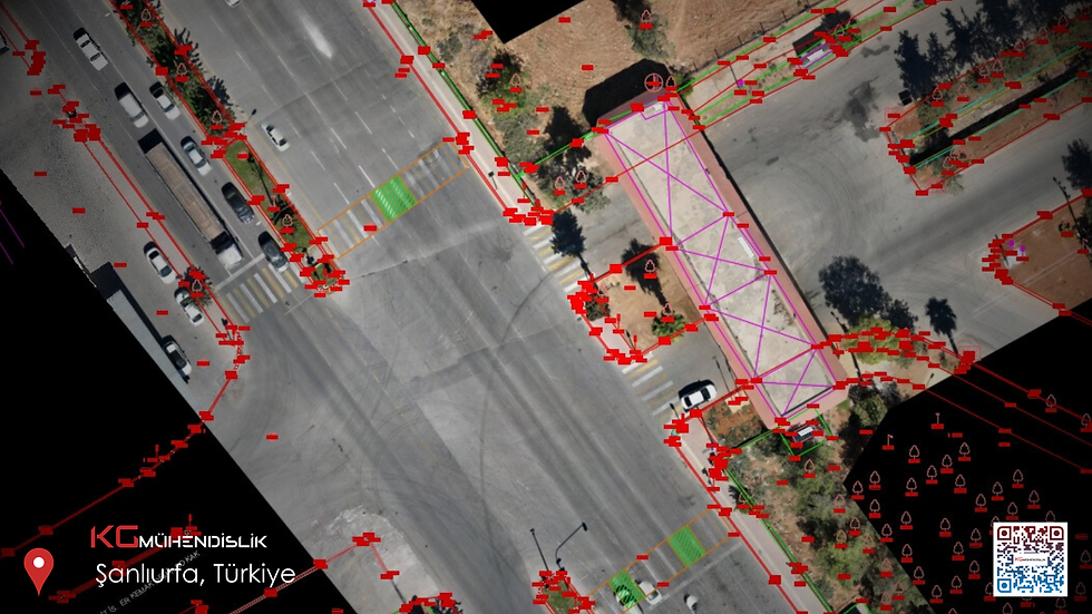
The drone currently glides using orthomosaic technology.
- The laser scan point cloud does not match the existing CAD system.
The problem, which begins with "a few centimeters of displacement", grows between the floors.
The solution usually does not consist of further scans, but rather of **verifying the epoch and coordinate system**.
What role does the historical period play at KG Engineering?
For our team in Istanbul, era control is a mandatory step, especially for the following projects:
- Production of existing maps
- Geodetic network and ground control point facilities
- 3D laser scanning / inventory and scan-to-BIM
- Maps and digital terrain models using drones.
Before the measurement, the reference system and epoch are defined; this is also documented upon delivery. This ensures that the data remains transferable for subsequent projects.
Frequently Asked Questions
**What is an era, in a single sentence?**
This refers to the time reference to which the measurement or the coordinate is linked.
**What does the era on the map mean?**
Specifies the time period for which the map or point data was generated; essential for merging and updating.
**Why are we asking about the starting era?**
Knowing the project's reference time is necessary to precisely align new measurements with the old data.
Are the era and the date the same thing?
No. The date/framework answers the question "Which system?", and the era answers the question "Which time period?". Both should be given together.
Should I perform the era conversion myself?
For critical projects (zoning, expropriation, inventory of facilities), professional monitoring is recommended; incorrect conversion leads to costly site redundancies.
Diploma
The answer to the question "What is an epoch?" can be found in a single line in a specialized dictionary; in practice, however, it is **the backbone of the project**. If you are working with GPS, ground leveling, GBP, or laser scanning, you cannot generate data without clarifying the epoch and the starting epoch.
For project-specific support regarding epochs, coordinate systems or ground control networks, you can contact [KG Engineering](https://www.kgmuhendislik.com) .


Comments