
Installation instructions for the geodetic network in Istanbul

The geodetic network is a coordinate system used to precisely determine the positions of land and buildings. It provides fundamental data for architecture, construction, industrial plants, and infrastructure projects. In large and complex cities like Istanbul, an accurate geodetic network is essential for the success of projects.
Installation guide for geodetic networks: Basic information and description
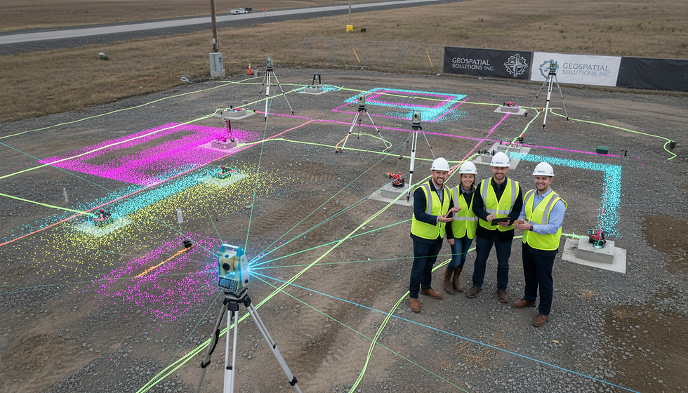
A geodetic network consists of reference points established to precisely determine the coordinates of points on the Earth's surface. These points are identified using GPS, total stations, and other measuring instruments. The network ensures horizontal and vertical accuracy, thus facilitating coordination in mapping, construction, and infrastructure projects.
Establishing a geodetic network involves not only identifying points but also precisely determining their relative positions. This minimizes measurement errors and ensures data consistency in large-scale projects.

Steps to installing a geodetic network in Istanbul
The installation of a geodetic network comprises several phases. Each step increases the accuracy and reliability of the project.
Planning and preparation
The map of the project area and the available geodetic data are being reviewed.
The installation locations will be determined.
The necessary equipment and personnel have been organized.
Field measurements
Field data is collected using total stations, GPS, and other measuring instruments.
The measurements are taken taking into account weather conditions and environmental factors.
The accuracy of the measuring points is checked.
Data processing and analysis
The collected data is processed in a computer environment.
Coordinates are calculated and error analyses are performed.
The field measurements will be repeated if necessary.
Network point fixation
The marked points are indicated with permanent markers.
The points are integrated into maps and projects.
Reporting and delivery
The installation results will be presented in a detailed report.
The necessary coordinates and map data will be provided to the project team.
These measures must be implemented sensitively in densely populated areas like Istanbul.
Points to consider when installing a geodetic network
Several critical points must be considered when installing a geodetic network:
Selecting the right equipment: Calibration and accuracy of the devices used directly influence the measurement results.
Environmental conditions: Istanbul's changeable weather conditions and dense urban development can complicate the measurement process. Therefore, timing is crucial.
Data verification: The consistency and error tolerances of the measurement data must be checked.
Point fixing: The permanent and visible marking of network points is necessary for future measurements.
Legal and technical standards: The installation of geodetic networks must comply with the relevant laws and standards.
These elements ensure the long-term success of the project.

The importance of installing a geodetic network in Istanbul
Istanbul, with its complex geography and dense urban development, offers a unique environment for the installation of geodetic networks. Carefully installed networks enable projects to achieve the following:
It increases sensitivity.
It saves time and money.
It facilitates coordination between projects.
Reduces risks.
Therefore, the installation of the geodetic network in Istanbul should be carried out by expert teams. KG Engineering offers services in this area using state-of-the-art technologies.
The role of technology in the installation of geodetic networks
The installation of geodetic networks is now supported by advanced technologies. 3D laser scanning, drone-based surveys, and modern GPS systems enable faster and more accurate acquisition of field data. These technologies include:
It reduces data collection time.
It increases the sensitivity rate.
It adapts to the field conditions.
This makes it easier to carry out complex projects in large cities like Istanbul.
Next steps in the installation of the geodetic network
After the geodetic network has been established, the data obtained should be actively used in projects. This phase includes:
Mapping and modeling are carried out.
It serves as a reference in construction and infrastructure projects.
Regular maintenance and inspection measurements are planned.
These processes ensure a smooth project flow and prevent potential errors.
The installation of geodetic networks is a cornerstone of projects in large and dynamic cities like Istanbul. With careful planning, precise measurements, and technical support, you can achieve reliable results in your projects. For more detailed information and professional support, collaboration with expert teams is always beneficial.
info@kgmuhendislik.com | (0536) 232 69 12


Comments