
Installation of a geodetic network in Istanbul: processes and key points

Geodetic networks are a system of reference points used for the precise location of properties and buildings. They form a fundamental data basis for architecture, construction, industrial plants, and infrastructure projects. In large and complex cities like Istanbul, accurate and reliable geodetic networks are crucial for the success of projects.
What is the installation of a geodetic network?
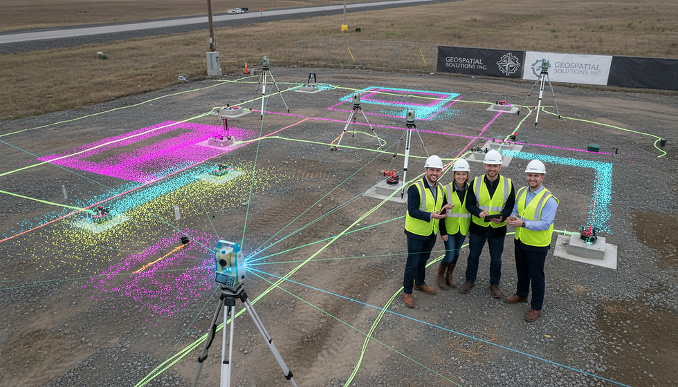
A geodetic network is a system of measuring points used to precisely determine the coordinates of points on the Earth's surface. These points are determined using GPS, total stations, and other precision measuring instruments. The network provides horizontal and vertical positional information, thus forming a solid reference basis for construction and infrastructure projects.
The installation of a geodetic network involves not only identifying points but also ensuring the accuracy of their relative positions. This minimizes measurement errors in projects and avoids structural inconsistencies.

Processes for installing geodetic networks in Istanbul
Due to the complex terrain and dense development, installing a geodetic network in Istanbul requires special planning. The process generally includes the following steps:
Project site analysis: In the first phase, the scope and requirements of the network to be built are determined. The terrain, existing infrastructure, and environmental factors are assessed.
Selection of reference points: The points forming the basis of the network are selected from accessible and stable regions. These points should show no changes in long-term measurements.
Preparation of measuring instruments: GPS, total stations and other geodetic instruments are calibrated and adapted to the field conditions.
Field measurements: Precise measurements are carried out at selected points. To minimize measurement errors, several measurements are taken during this phase.
Data processing and analysis: The collected data is processed using software. Coordinate relationships between points are calculated and the accuracy of the network is checked.
Network release and reporting: The results are submitted to the relevant institutions and their approval is obtained. The network is then documented as ready for use.
These steps must be carefully implemented in dynamic and densely populated cities like Istanbul to ensure a smooth project flow.
Points to consider when installing a geodetic network
Several critical points must be considered when installing a geodetic network:
Selection of stable points: The base points of the measurement network should be chosen in locations that are not affected by ground movements. Otherwise, measurement deviations will occur.
Technology and equipment calibration: Using current and calibrated equipment increases measurement accuracy.
Monitoring of environmental conditions: Weather conditions, electromagnetic interference and other environmental factors can affect the measurement results.
Data backup: Measurement data should be backed up regularly and stored in secure environments.
Specialist personnel: Measurement and analysis processes should be carried out by experienced teams.
These elements ensure the reliability and longevity of the geodetic network.

The contribution of installing geodetic networks to projects in Istanbul
In large cities like Istanbul, infrastructure and construction projects are complex and multifaceted. Carefully established geodetic networks offer the following advantages for these projects:
Precise positioning: The exact location of buildings and infrastructure elements is determined.
Time and cost savings: Measurement errors are reduced and the need for rework decreases.
Safety: By avoiding structural inconsistencies, safe buildings are constructed.
Data integration: Comprehensive digital models are created through the integration of 3D laser scanning and other digital technologies.
These advantages significantly simplify the planning and implementation phases of projects.
Services and advanced technologies for the installation of geodetic networks in Istanbul
Today, the installation of geodetic networks is no longer limited to traditional measurement methods. Faster and more precise results are achieved through 3D laser scanning, drone-based measurements, and advanced software. These technologies are particularly preferred for complex and large-scale projects.
KG Engineering has a team in Istanbul specializing in creating digital models of buildings using 3D laser scanning and digital solutions. This enables the rapid acquisition and analysis of field data, ensuring access to current and accurate data at every stage of a project.
The installation services for geodetic networks in Istanbul , supported by these advanced technologies, offer their customers comprehensive and reliable solutions.
Recommendations for successful geodetic network installation
Pay particular attention to the planning phase: Conduct a detailed analysis before the project begins and clarify the scope of the network.
Use the correct equipment: Take measurements with up-to-date and calibrated devices.
Continuous professional development: Train your employees in new technologies and methods.
Data management: Regularly check and back up measurement data.
Collaboration: Facilitate data exchange through coordination with project stakeholders.
These recommendations improve the quality of geodetic network installations and ensure a smooth project flow.
The installation of geodetic networks is a cornerstone of projects in large and complex cities like Istanbul. Careful planning, precise measurements, and the use of state-of-the-art technologies make projects safer and more efficient. KG Engineering creates digital models of structures and provides its clients with highly accurate data through comprehensive services in this field. Professional support during the installation of geodetic networks guarantees project success.
To learn more about installing geodetic networks in Istanbul and to take the right steps for your projects, you can contact our expert teams.


Comments